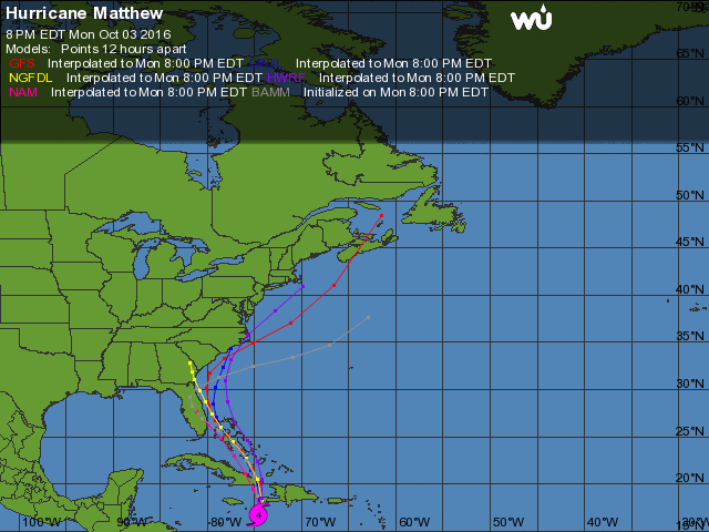
Previously, storm models had largely predicted that Hurricane Matthew would stay east of the Atlantic states, but all that has changed.
The cone of probability shows that the storm could make landfall on the east coast of Florida or move out to sea, but the updated forecast track from 8pm Monday night now puts the greatest likelihood of U.S. landfall in North Carolina as a category 2 hurricane with maximum sustained winds of up to 110mph.
These models are better at forecasting path than intensity so those in the forecast track should prepare for a stronger storm than predicted.
Computer models show that Matthew could take a variety of tracks.
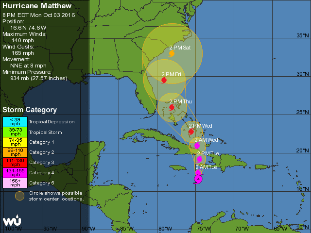
Current Information on Hurricane Matthew:
- Location: 16.6N 74.6W
- Movement: NNE at 8 mph
- Wind: 140 MPH
- Pressure: 934 MB
Support Conservative Daily News with a small donation via Paypal or credit card that will go towards supporting the news and commentary you've come to appreciate.