Hurricane Matthew Storm Tracker – 10/8/16 – 8pm Update – soon to be downgraded – headed out to sea
Hurricane Matthew’s track has changed repeatedly over the last 24 hours and will likely cause catastrophic damage to southern Atlantic coast states. As such, CDN will now use this single post to provide updates with the newest information at the top of the page. Check back frequently for updates*
Check our Hurricane Matthew page for all the latest posts on this powerful storm and the new #Matthew Live Video Page.
Sections (click to navigate):
- Summary
- Current Storm Position
- Storm Tracking Map
- NHC Advisories
- Storm Surge Risk and Rain Forecast (flood risk)
- Wind strength probability maps
- Computer Models
Hurricane Matthew Forecast Track and Update 10/8/16 8pm (last update)
- Location: 33.8N 77.3W
- Movement: ENE at 13 mph
- Wind: 75 MPH
- Pressure: 981 MB
- Mathew will soon be downgraded to a tropical storm, turn east and head out to sea where it will dissipate
Hurricane Matthew Current Position
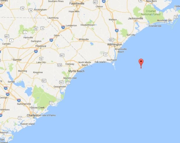
Matthew is just barely a Hurricane with 75 mph top sustained winds, but is producing huge amounts of rain in North Carolina causing major flooding. The storm will turn eastward and head out into the Atlantic Ocean before dissipating.
The given track is not a certainty as the storm could end up tracking anywhere within the white cone of probability.
Storm Track
![]()
From the NHC:
On the forecast track, the center of Matthew will be near the coast of
southern North Carolina by this evening.
Matthew is a category 1 hurricane on the Saffir-Simpson Hurricane Wind Scale.Although weakening is forecast during the next 48 hours, Matthew is expected to remain near hurricane strength while the center is near the coasts of North CarolinaHurricane-force winds extend outward up to 25 miles (35 km) mainly over water to the east of the center. Tropical-storm-force winds extend outward up to 185 miles (295 km). Multiple private weather stations along the coast of South Carolina near Myrtle Beach have recently reported hurricane-force wind gusts.
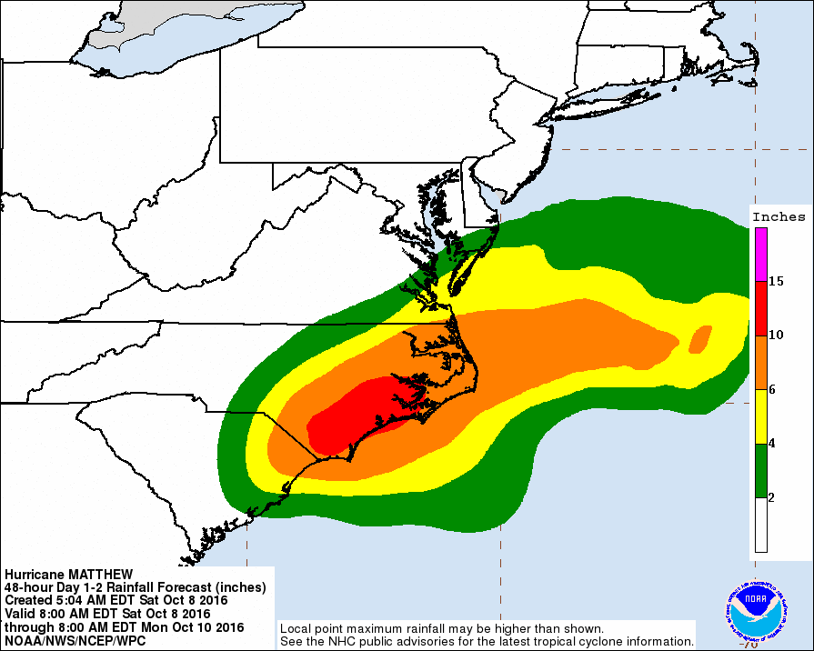
Storm Surge and Rain (flood risks)
North Carolina could see 15″ of rain in some locations.
Storm Surge Inundation: (blue = 1-3ft, yellow 3-5ft, orange 5-7ft, red 7-9+ft)
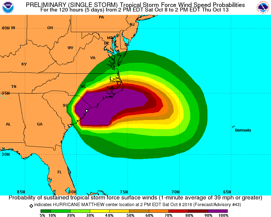
Wind Predictions and Information:
Computer Models
Consensus among the models has formed for the storm’s track showing the storm curving around for a second hit on the Bahamas and possibly Cuba.

model data used: https://tropicalatlantic.com/models/google_earth/Models_for_the_North_Atlantic_Basin.kmz